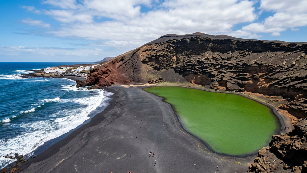
A volcano split clean in half. Inside, a lagoon of impossible green. In front, a black sand beach. Behind, a red cliff. And all of it packed into twenty metres.
The Charco de los Clicos is the photo that made you want to come to Lanzarote in the first place, the one that looks Photoshopped. It isn't. And the best bit is you can see it in fifteen minutes, it's right next to Timanfaya, and it ends in a fishing village where you eat brilliantly.
Here's exactly what it is, why it's green, how to get there — there's a trick to it — and what else there is nearby.
What the Charco de los Clicos actually is
This used to be a volcano. It's called Montaña del Golfo, and the sea ate it clean in half: what you see today is half a crater, an amphitheatre of reddish and ochre walls open to the Atlantic, with the lava layers on full display, as if someone had sliced the mountain with a knife.
At the bottom of that half-crater sits a lagoon. It has no river or spring feeding it: it's seawater that filters through under the volcanic sand. It's separated from the ocean by a strip of black sand just a few metres wide. Salt sea on one side, green lagoon on the other, and a dark beach in between.
clicos were a type of mollusc once gathered here, which gave the pool its name. There aren't any left. The name stuck around; they didn't.
Why is it green?
Because of algae. In that still, salty water grows an aquatic vegetation that stains the lagoon that dense, opaque green that looks like paint. Add to that the volcanic minerals in the area — this spot is famous for olivine, that semi-precious green crystal you'll spot mixed into the sand and sold in shops across the island.
So: it's not a lake, it's not just algae, and it's definitely not a Photoshop trick. It's a broken crater, filtered seawater, and biology. One of the strangest spots in the Canaries.
How to get there (here's the trick)
The usual confusion: El Golfo the village and the Charco de los Clicos aren't in the same place. There are two separate access points, and plenty of people park at the wrong one.
To see the lagoon → the southern viewpoint. Coming from Yaiza along the LZ-703, there's a signposted car park before you reach the village. From there it's a five-minute walk to the viewpoint, right in front of the lagoon. That's the view from all the photos.
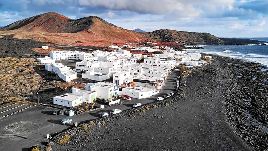
To eat and see the village → El Golfo itself. Carry on a couple of kilometres further. White houses, boats and fish restaurants facing the Atlantic.
Worth knowing: you can't go down to the lagoon. It's protected, the slope is prone to landslides, and the old path from the village has been off-limits for years. You admire it from the viewpoint, full stop. If you see photos of people at the water's edge, they're old or they're reckless.
And no, don't swim here. Not in the lagoon (protected) and not on the black beach either: there are strong currents and the sea comes in hard. This isn't a swimming beach. The best beaches in Lanzarote »
You'll need a car. No bus (guagua) comes out here. Getting around Lanzarote »
When to go: light is everything
The Charco faces west. Which means:
- In the morning you get it backlit. You can still see it, but the green looks flat.
- In the afternoon, and especially the last hour of light, the sun hits it face-on: the red of the crater burns and the green turns electric. That's the hour to be there.
- Under overcast skies or calima (dust haze), the colour just disappears. This is a place that lives and dies by the sun.
Allow 20-30 minutes for the viewpoint. It's a stop, not an outing.
The village of El Golfo
There's nothing to "see" here in the touristy sense: you just need to be there. A handful of white fishermen's houses, boats, and a row of fish restaurants with tables facing the Atlantic, which breaks right below them.
It's one of the island's classic spots for fresh fish — vieja, cherne, sama — with papas arrugadas (wrinkly potatoes) and mojo sauce, watching the sun go down.
in high season and at weekends, book ahead. The front-row tables fill up at sunset, which is exactly when you want to be there.
What's nearby (don't just come for this)
The Charco sits on the southwest circuit, the most spectacular road in Lanzarote. String them together:
- Los Hervideros (5 minutes south): lava cliffs where the Atlantic pushes in through the rock and explodes out through the cracks. With the right tide and wind, it's quite a show. Free.
- Salinas de Janubio (10 minutes): the mosaic of pink and ochre salt pans. At sunset, unbeatable.
- Timanfaya (25 minutes): the volcano. Book online, fixed time slot. How to visit Timanfaya »
- La Geria (25 minutes): the vineyards grown in pits. La Geria wineries and wine »
Timanfaya first thing → lunch in La Geria → El Golfo → Los Hervideros → sunset at Janubio. We cover the whole thing in the 3-day itinerary ».
FAQs
What is the Charco de los Clicos?
Why is it called "de los Clicos"?
Can you go down to the lagoon?
Can you swim in El Golfo?
How long does it take to see?
What's the best time to go?
Do you have to pay?
Are El Golfo and the Charco de los Clicos the same thing?
Lanzarote has spent three hundred years teaching lessons about what fire can do. The Charco de los Clicos argues the opposite: here, the spectacle wasn't made by the volcano, but by the sea biting it away bit by bit until it lay open like a wound.
A split crater, a green pool, and a black beach. Fifteen minutes of your trip. And the photo that's going to end up as your cover shot.