You won't be walking through trees here. No shade, no rivers, no woodland. There's lava, sand, wind and a silence that simply doesn't exist back on the mainland.
And that's exactly why Lanzarote is one of the best places in Europe for walking. You can climb inside a crater, skirt round a three-kilometre-wide caldera, or descend a 600-metre cliff to a beach with no road access whatsoever. All in the same day, and nearly all of it free.
Here are the hiking trails in Lanzarote that are actually worth your time, ranked by difficulty, with the bits nobody bothers to mention.
First things first: timing. This is a November-to-April destination for walking. In July and August, with the sun directly overhead, zero shade and black rock radiating heat back at you, it's not just uncomfortable — it's genuinely dangerous. Best time to visit Lanzarote
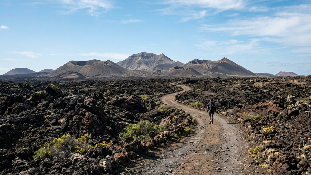
Easy: for anyone
El Cuervo volcano — the island's best first hike
~5 km · 1 h 30 · easy · loop · free
You actually walk inside a volcano. El Cuervo's crater is open on one side, and that's your way in: suddenly you're inside an amphitheatre of red and black walls, sky above you and a silence that presses on your ears.
It sits right on the LZ-56 road, near Mancha Blanca, and the path loops around the cone and into the crater. Flat, short and spectacular. This is the one you send to someone who insists they don't like walking.
go at sunrise or sunset. With the sun low, those walls seem to glow.
Montaña Roja — views over to Fuerteventura
~3 km · 1 h · easy · Playa Blanca
A reddish cone right behind Playa Blanca. Climb it and you'll have Fuerteventura straight ahead, Papagayo off to one side and half the island on the other. The perfect walk before lunch if you're staying in the south.
Las Grietas de Montaña Blanca
Short · easy · very fragile
The island's secret canyon: narrow corridors of cracked lava that you wind through like a maze. We've covered it in full elsewhere:
A genuine request here: this place is fragile. The rock breaks and crumbles, and it doesn't regenerate. Every person who wanders off the path, climbs where they shouldn't, or takes a piece with them is taking away part of something that's been there for thousands of years. Stick to the path, don't touch anything, don't take anything.
Moderate: half a morning, and worth every step
Caldera Blanca — the queen of them all
~10 km · 3-4 h · moderate · free
If you only do one hike in Lanzarote, make it this one.
You set off from Mancha Blanca and cross the 1730 lava sea — quite literally: you're walking across the flow that buried the island, over the malpaís (badlands), with Timanfaya on one side. Ahead, the Caldera Blanca rises up — an ancient volcano the lava surrounded without swallowing it whole.
You climb to the crater rim, and that's when it clicks why you came: a basin nearly a kilometre across right at your feet, with the lava sea and the Fire Mountains all around. It's the best view of Timanfaya you'll get anywhere… and it's free, no booking, no bus required. How to visit Timanfaya
the terrain is malpaís — sharp rock that shreds trainers and ankles alike. Proper footwear is non-negotiable.
Los Ajaches: from Playa Blanca to Papagayo
~8 km one way · 2-3 h · moderate (flat)
The coastal path running from Playa Blanca to the Papagayo coves, skirting ochre cliffs with Fuerteventura in view the entire way. Flat, no shade, sea always on your right.
you reach Papagayo on foot, no dirt track, no car fee and no hunting for parking in August. Swim, then head back. The best beaches in Lanzarote
La Corona volcano
~5 km · 2 h · moderate · Yé
The volcano that created the tube tourists now walk through at Jameos del Agua and Cueva de los Verdes. You climb to the crater rim, in the green north, with views over La Graciosa and the Risco. Haría and the Valley of a Thousand Palms
Tough: for those who came here specifically for this
Camino de los Gracioseros and Playa del Risco
~5 km there and back · 2-3 h · tough due to the elevation change
The best walk in Lanzarote, and the most demanding. You descend down the Risco de Famara cliff face to a beach with no road access at all, La Graciosa right in front of you, close enough to feel like you could touch it. Down at the bottom you'll also find the Salinas del Río, the oldest salt pans in the Canaries, now abandoned.
This is the very path the people of La Graciosa used to walk down to cross over to Lanzarote, loaded up with goods. Bear that in mind while you do it.
the descent is easy; the climb back up is what you pay for it. No shade, a steep incline and loose ground underfoot. Budget double the time for the return leg, bring double the water, and don't attempt this in summer or when the wind is strong. La Graciosa in a day
GR 131: the island end to end
Several stages · a multi-day undertaking
The long-distance trail that crosses Lanzarote from end to end, from Órzola to Playa Blanca. Done in stages, it's a whole different way of experiencing the island: walking from village to village, through an interior most visitors never see.
And the ones inside Timanfaya
Inside the National Park you can't just wander off on your own, but there are guided routes:
- Tremesana (~3 km): guided, in very small groups. You need to book well ahead — it sells out fast.
- Ruta del Litoral (~9 km): also guided, along the park's coastline.
It's about as close as you'll get to actually setting foot in Timanfaya, rather than just watching it go by through a bus window. Check how to book them: it's the thing fewest people know about this park.
The warnings that genuinely matter here
- There's no shade. None. On any of the routes on this list.
- Water: 2 litres per person. There are no fountains anywhere.
- The malpaís destroys footwear. It's sharp volcanic rock. No fabric trainers, no flip-flops.
- The wind. The trade wind (alisios) blows constantly, and even more so on crater rims and along the Risco. Always pack a windbreaker.
- Stay on the path. Two reasons: the lava is hollow in places and can give way beneath you — resulting in a broken ankle or worse — and the lichens you see on the rock take decades to grow and are destroyed by a single footstep.
- Start early. At 8am the island is yours and the light is at its best.
- Patchy signal. Let someone know your route.
- Calima (Saharan dust haze): if the air looks hazy and yellow, save the hike for another day.
- Car. Every one of these spots is reached by car, and none by bus (guagua). How to get around Lanzarote
FAQs
What's the best hiking trail in Lanzarote?
What if I'm not much of a walker?
Can you hike inside Timanfaya?
When's the best time for hiking in Lanzarote?
Do you need a guide?
Can you go with kids?
Do you have to pay?
In Lanzarote, you walk across the exact spot where an island once tore itself apart. There's no woodland to distract you, no river to keep you company: just you, the rock and the wind.
And at some point — usually up on a crater rim, with the lava sea spread out below — it hits you that you're standing on something that was on fire less than three hundred years ago. No tour bus will ever give you that.